Managing ocean sustainability from above: leveraging space capabilities to combat illegal fishingby Cody Knipfer
|
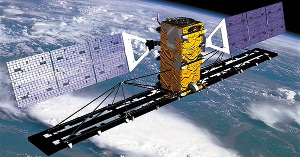
| Space capabilities such as satellite radar and multispectral imaging are making it easier for the international community to track, characterize, and combat illegal fishing. |
Managing illegal fishing requires effective and global monitoring tools, a challenge for enforcement. While most commercial vessels utilize tracking systems such as the “Automatic Information System” (AIS) and the “Vessel Monitoring System” (VMS), disabling them is a common practice in illegal fishing. Smaller vessels often lack these systems altogether.[13] This is made more complicated by fishing vessels registering, through “flags of convenience,” with states with weak regulatory controls.[14] In the absence of strong regulatory oversight, these boats’ operators can more easily evade enforcement. Perpetrators often sail from, or sell their catches at, ports that lack the infrastructure, resources, or incentive to conduct comprehensive screening.[15] This is a critical problem, as ports are where most—and the most effective—inspection and enforcement activities take place.[16]
Monitoring from above: the role of satellite capabilities
Nonetheless, the international community is making progress preventing illegal fishing, with space capabilities helping overcome these challenges. As overhead monitoring platforms, satellites provide actionable intelligence that assists in tracking of and enforcement against perpetrators. Recent developments in satellite technology and the satellite market have facilitated global coverage and rapid revisit times.[17] Along with new sensing applications and AI-driven data analysis,[18] these have made satellites important tools for counter-IUU fishing initiatives.[19]
With wide fields of view and global reach, satellites can identify and continuously monitor vessels in ways infeasible with land, sea, or air assets. Satellites equipped with synthetic aperture radar (SAR) can generate radar images of Earth’s oceans. SAR can detect vessels through darkness and strong weather, even if they aren’t transmitting AIS or VMS signals.[20] Other satellites monitor radiofrequency (RF) spectrum for emissions. These can pinpoint unique radio signatures and transmissions from ships, enabling tracking when AIS or VMS is shut off.[21] Satellite-based visible infrared imagers can detect the infrared signature of brightly lit boats, making them suited to track vessels that operate at night, such as squid boats.[22]
These diverse datasets, fed through AI analysis featuring real-time edge computing[23] and machine learning,[24] enable authorities to quickly identify discrepancies in vessel behavior that may point to suspicious activity such as illegal fishing.[25] Coupled with optical imagery, it allows for persistent tracking of flagged vessels from fishing grounds back to port, where authorities can prepare to confront suspected perpetrators or those who are sheltering them.[26] Likewise, this data helps spot and stop “trans-shipments,” in which illegal catches are transferred from the offending fishing boat to another.[27]
| When employed with the right technical expertise, satellites are becoming increasingly valuable tools to predict, identify, and pursue illegal fishing. |
Satellites also provide data for preemptive planning against illegal fishing. Hyperspectral imaging, used on satellites such as ESA’s Sentinel, measures oceanic conditions ranging from temperature and depth, to the distribution and abundance of marine life.[28] Satellites like NOAA’s JPSS are used to geolocate tagged oceanic wildlife, identifying where they congregate and migrate.[29] Together, this data provides understanding of the location, size, and movement of marine populations.[30] With that information, authorities can better allocate resources to and prioritize inspection and enforcement in current or predicted areas with large fish populations, which are at highest risk of illegal fishing.
From tracking to enforcement: putting satellite capabilities to use
Satellite-derived intelligence is already being put to effective use by NGO, national, and international counter-IUU fishing initiatives. For example, the United States is leveraging satellite SAR data to support illegal fishing enforcement through the multilateral Indo-Pacific Partnership for Maritime Domain Awareness.[31] Canada, in partnership with Ecuador, has launched a “Dark Vessel Detection” program that utilizes satellite capabilities to locate vessels that have turned off AIS or VMS tracking.[32] The NGO Global Fishing Watch has created an open-source, interactive online map of global ocean traffic,[33] for public and government use, that analyzes satellite data[34] to support efforts against illegal fishing.[35] Similarly, the NGO Pew Charitable Trusts has launched “Project Eyes on the Seas,” which synthesizes satellite data in real-time to detect suspicious fishing activity.[36]
These initiatives are strong models for future multilateral initiatives. Satellite tracking of vessels, for example, can support stronger implementation of the UN Agreement on Port State Measures (PSMA), which seeks to deter illegal fishing by denying port access to foreign vessels that engage in such practices.[37] By monitoring illegal fishing traffic into and out of ports, satellites can identify, and help report through the PSMA Global Information Exchange System, offending states that require more competency-building to meet their PSMA obligations.[38]
Space capabilities alone won’t prevent illegal fishing, nor address its causes. Winning the fight against illegal fishing will require effective regulation, enforcement, partnerships, and international buy-in.[39] Still, when employed with the right technical expertise, satellites are becoming increasingly valuable tools to predict, identify, and pursue illegal fishing. Through satellite data, it is hard for perpetrators to hide from enforcement. By leveraging these capabilities, the international community will better manage ocean sustainability—by monitoring it from above.
References- “A Healthy Ocean Depends on Sustainably Managed Fisheries,” The Nature Conservancy. January 25, 2021.
- “Goal 14: Conserve and sustainably use the oceans, seas, and marine resources,” United Nation Sustainable Development Goals.
- Ibid.
- Tim White, “Recent Study Shows How Satellite Technology Can Help Track Illegal Fishing Throughout the Pacific Region,” Global Fishing Watch. March 21, 2022.
- Jamie Seidel, “Illegal fishers and wayward sharks are in the sights of new multispectral imaging,” Cosmos Weekly. June 17, 2022.
- Patrick Tucker, “Can We Spot Illegal Fishing Fleets from Space?” Defense One. August 4, 2021.
- “Up to 1 in 5 Fish Sold is Caught Illegally – and Other Surprising Illegal Fishing Facts.” Pew Charitable Trusts. November 13, 2017.
- Dan Collyns, “Illegal fishing spurs billions in losses for developing countries, study says,” The Guardian. October 26, 2022.
- “Oceans crucial for our climate, food and nutrition,” Food and Agriculture Organization of the United Nations. September 25, 2014.
- Chardynne Joy H. Concio, “Ocean Habitats Are on a Steep Decline,” The Science Times. June 12, 2019.
- Ed Holt, “Counting the Massive Financial Costs of Illegal Fishing,” Global Issues. November 2, 2022.
- “Half of industrial IUU fishing vessels operate in Africa, majority Chinese and European – new report,” Financial Transparency Coalition. October 26, 2022.
- Leslie Roberson, “Global fisheries need monitoring, but satellites alone won’t help,” Sparrow. August 12, 2019.
- “Off the Hook: How flags of convenience let illegal fishing go unpunished,” Environmental Justice Foundation. 2020.
- Kristín von Kistowski, Stefan Flothmann, Gunnar Album, Emily Dolan, Adriana Fabra, Elsa Lee, Marta Marrero, Frank Meere, Karen Sack, “Port State Performance: Putting Illegal, Unreported and Unregulated Fishing on the Radar,” The Pew Environment Group. August 2010.
- “Ports and Voyages: Identifying maritime supply chains and supporting risk assessment,” Global Fishing Watch.
- Jonathan O’Callaghan, “Swarms of Satellites Are Tracking Illegal Fishing and Logging,” Wired. August 30, 2022.
- Will Marshall, Jeffrey Tarr, “How satellite surveillance is hauling in illegal fishers,” World Economic Forum. October 3, 2017.
- Douglas McCauley, “How Satellites and Big Data Can Help to Save the Oceans,” Yale Environment 360. April 13, 2016.
- Gavin Haines, “‘No place to hide’ for illegal fishing fleets as surveillance satellites prepare for lift-off,” Mongabay. August 30, 2019.
- “Satellite RF Tracking Follows the “Dark” Ships That AIS Can’t See,” The Maritime Executive. July 26, 2022.
- Mike Wall, “Satellites uncover widespread illegal fishing in Pacific Ocean,” Space.com. July 22, 2020.
- Carlyn Kranking, “Combatting Illegal Fishing with Space-Based Edge Computing,” Payload. July 19, 2022.
- Alex Thorton, “How AI and satellites are used to combat illegal fishing,” Microsoft. June 6, 2019.
- Tim White, “Recent Study Shows How Satellite Technology Can Help Track Illegal Fishing Throughout the Pacific Region.”
- Tony Long, “How Satellite Technology Is Helping End Illegal Fishing in Our Ocean,” Pew Charitable Trusts. September 2, 2016.
- Will Marshall, Jeffrey Tarr, “How satellite surveillance is hauling in illegal fishers,” World Economic Forum.
- “Satellites Support Sustainable Fishing,” Copernicus. September 2013.
- “Fisheries Scientists to Reap Benefits from New NOAA Satellite,” NOAA Fisheries. November 16, 2017.
- Ibid.
- Calvin Biesecker, “Biden Administration Directs Use of Technology to Combat IUU Fishing,” Satellite Today. June 30, 2022.
- “Government of Canada launches international program to track illegal fishing using satellite technology,” Fisheries and Oceans Canada. February 24, 2021.
- “Our Map,” Global Fishing Watch.
- “Our Technology,” Global Fishing Watch.
- David Hambling, “Global satellite map will help hunt down illegal fishing vessels,” New Scientist. June 16, 2022.
- “Project Eyes on the Seas,” Pew Charitable Trusts. March 16, 2015.
- “New milestone in battle against illegal, unregulated fishing,” UN News. November 7, 2022.
- “PSMA Global Information Exchange System,” Food and Agriculture Organization of the United Nations.
- James Movick, “The use of satellite technology in combatting IUU fishing in the Pacific Islands region,” Presentation to the 2019 International Symposium on Maritime-Space Cooperation in the Asia Pacific Region. 2019.
Note: we are using a new commenting system, which may require you to create a new account.