A North Korean satellite starts showing signs of life (part 2)by Marco Langbroek
|
| The specific moments these maneuvers were initiated match passes over North Korea, it turns out. |
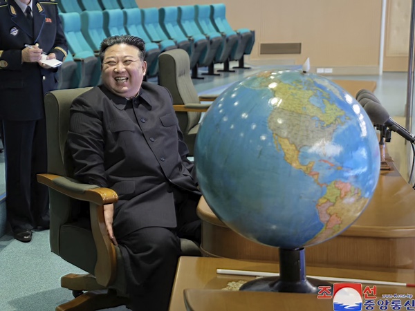
NATA (formerly NADA), the North Korean National Aerospace Technology Administration, has a satellite control center, the Pyongyang General Satellite Control Center (PGSC), on the south shore of the Pothong river in the northern part of Pyongyang (39.0425 deg N, 125.7100 deg E). It is a large oval building with several sub-buildings attached. Images of the main control room’s interior were shared by the North Korean State Press Agency KCNA in the days after the launch of Malligyong-1, connected to a visit by Kim Jong Un to the facility on November 22, 2023, when he purportedly watched incoming imagery transmissions by the then just-launched satellite. Presumably, maneuvering commands sent to Malligyong-1 are issued from this control room too. It is not clear if the actual radio transmitter sending the commands to the satellite is also located at the PGSC, but it is likely. What appear to be two satellite dishes can be seen outside the building on the Northeast corner of the complex in Google Earth imagery.
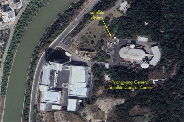 An annotated Google Earth image of the Pyongyang General Satellite Control Center |
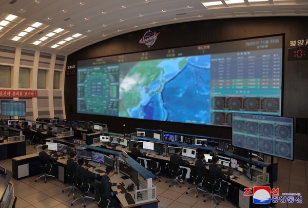 The Pyongyang General Satellite Control Center interior in November 2023 (credit: KCNA) |
Following the detection of the series of five incremental orbit raising maneuvers, one per day, between February 19 and 24 (see the March 4 article), I have analyzed the available tracking data to see if I could determine the approximate times and locations of the orbit maneuvers. This can be done by, for each case, taking the last orbit determined before the maneuver and the second orbit determined after the maneuver (the first is usually not that accurate, hence why the second is used.)
Next, an analysis akin to a collision avoidance (COLA) analysis is done with these orbits: you treat the pre-maneuver orbit and post-maneuver orbit as if they are for two separate objects, and determine when these two “objects” would have a close approach within the window between the last pre- and first post-maneuver orbit. This gives you an approximation of the time and location of the maneuver.
The close approach analysis was done with custom COLA software, using TLE data for the pre- and post-maneuver orbits sourced from the US military Combined Space Operations Center’s satellite orbit catalogue (www.space-track.org). To determine which orbits correspond to pre- and post-maneuver orbits, I looked for sudden “jumps” in the semi-major axis in the orbital data.
I found the following nominal maneuver moments and nominal maneuver locations, shown in the table below. Note that these will have unknown uncertainties associated to them (as will be further discussed below) related to uncertainties in the orbit determination, so should not be taken as accurate to the nearest minute and nearest degree. We should take into account here as well that orbit raising maneuver burns are not instantaneous, but instead have a certain duration.
| Mnr | NOMINAL DATE (UTC) | LAT | LON | pre-orb epoch | post-orb epoch | o-raise | p-raise |
|---|---|---|---|---|---|---|---|
| #1 | 2024-02-19 14:04 | 76.1 | 150.8 | 24050.56731205 | 24050.96167074 | 0.136 | 0.289 |
| #2 | 2024-02-20 13:52 | 46.2 | 130.0 | 24051.61893252 | 24051.94760090 | 0.464 | 0.949 |
| #3 | 2024-02-21 13:34 | 36.4 | 132.1 | 24052.60492448 | 24052.93368053 | 1.165 | 2.297 |
| #4 | 2024-02-22 13:02 | 78.8 | 175.3 | 24053.13092727* | 24054.11730211 | 1.131 | 2.379 |
| #5 | 2024-02-23 12:56 | 31.7 | 140.7 | 24054.11730211* | 24055.49860887 | 1.121 | 2.345 |
For the two orbits marked by an asterisk, I took the orbit corresponding to one orbit determination before the last pre-maneuver orbit available, as there were indications that the last orbits were questionable (as indicated by them being double-issued for the same epoch.) The last two columns (“o-raise” and “p-raise”) give the nominal increase in semi-major axis and the nominal increase in perigee altitude in kilometers for each maneuver.
| The correlation with passes over North Korea underlines that North Korea seems to control the satellite from its own control center in Pyongyang and has not outsourced it, for example, to Russia or China. |
All determined maneuver times cluster between 13h and 14h UTC, a time window which corresponds to one of two moments in the day during which the orbital plane of Malligyong-1 is passing over North Korea. It corresponds to 22h and 23h (10 pm and 11 pm) local time in North Korea. That all maneuvers were done during the late evening passes (i.e. nighttime), and not the late morning passes (daytime, during office hours), is an interesting observation. Perhaps the daytime passes are strictly reserved for receiving imagery transmissions, i.e. “normal” operations.
Below I have plotted the determined nominal maneuver positions on a map (colored crosses). With each position, a part of the ground trajectory of the pass in question is given as well (colored lines), starting 10 minutes before the nominal time of maneuver and ending 10 minutes after the nominal time of maneuver. All movement on these passes is from north to south.
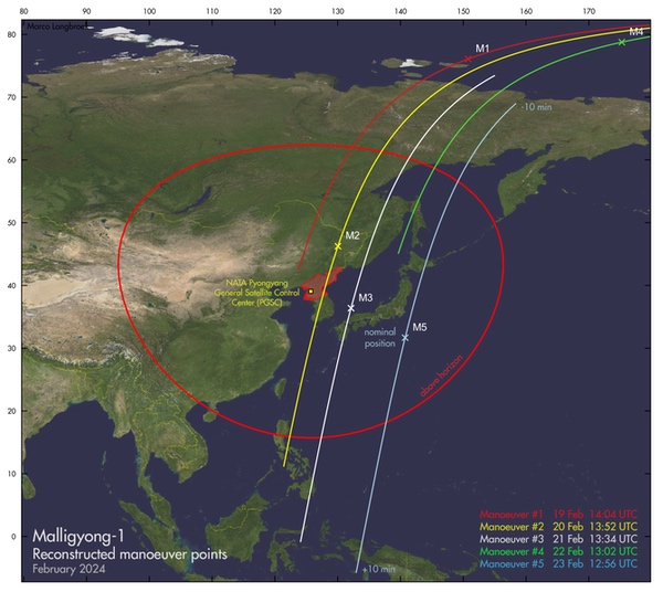 A map with the calculated nominal manoeuver positions, and 10-minute ground tracks on either side of the nominal locations |
The red oval around the Pyongyang Control Center PGSC in the map is the geographical limit of visibility of Malligyong-1 from this control center. When the satellite is geographically situated within this oval, it is above the horizon as seen from the PGSC, and direct line-of-sight radio contact with it is possible. The oval has an approximate radius of 2,600 kilometers.
Clearly there is a correlation of the maneuvers with passes over the Pyongyang General Satellite Control Center. Three of the five times and positions determined actually fall within the area where the satellite is above the horizon as seen from the PGSC. For the two that do not, the satellite would pass within the area within minutes of the determined time. Given that analyses like these will have some uncertainty in the determined maneuver time (and from that the location), the real locations where these two maneuvers were instigated are likely to have been within direct range of the PGSC as well.
The correlation with passes over North Korea underlines that North Korea seems to control the satellite from its own control center in Pyongyang and has not outsourced it, for example, to Russia or China. It also suggests that radio contacts between the satellite and its operators might only happen (and might only be detectable by independent monitoring stations) when the satellite is above the horizon in Pyongyang.
Note: we are now moderating comments. There will be a delay in posting comments and no guarantee that all submitted comments will be posted.