Flight of a feather: the QUILL radar satelliteby Dwayne A. Day
|
| For decades the identity of the payload remained classified, although a few independent satellite observers—the space field’s equivalent of trainspotters—recognized that this was an unusual bird that did not operate in the same kind of orbit as other, much more common reconnaissance satellites. |
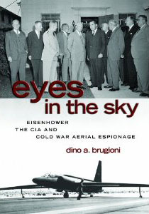
The book is Eyes in the Sky, by Dino Brugioni. Brugioni is a retired senior analyst who for years worked for the National Photographic Interpretation Center (NPIC, or “enpic”). During his time in the intelligence community, Brugioni briefed presidents from Eisenhower to Ford about things spotted in American spy satellite photography. Over the years Brugioni has written a number of informative books on such subjects as the Cuban Missile Crisis and photo-fakery.
In Eyes in the Sky, Brugioni briefly discusses QUILL. Spy satellite photography is limited by cloud cover and during the Cold War photo interpreters were frustrated by the fact that so much of the Soviet Union was cloudy all the time. It might take years to return photographs of certain regions. Radar offered a possibility for peering through the clouds.
According to Brugioni, the president of Polaroid, Edwin “Din” Land, who was also a senior advisor to the government on intelligence matters, recommended that the government experiment with radar and infrared systems that could peer through clouds to find and image large military installations. So the NRO started QUILL, which included Boeing, Goodyear, and the Environmental Research Institute of Michigan.
Proposals to start a radar satellite during the Eisenhower administration had apparently gone nowhere because of a concern that beaming signals down into the Soviet Union could be interpreted by the Soviets as a hostile act and result in retaliation against American reconnaissance satellites. When QUILL was initiated, senior government officials—although Brugioni does not say who, this possibly included the president—ordered that the tests could only be conducted over the United States. Brugioni writes that an early question was whether an aircraft radar could be adapted to the space mission or if a dedicated radar needed to be developed. He does not say what they concluded, although it seems possible that a Goodyear radar then in use on an aircraft would be a possible choice.
When QUILL was launched, according to Brugioni it was operated over Michigan, Illinois, Ohio, and the northwestern United States. The radar images were recorded onboard the satellite, possibly by photographing a radar scope in flight and gathering the exposed film into a CORONA-type satellite recovery vehicle and returning it to Earth.
NPIC photo-interpreters were asked to look at the images. According to Brugioni:
A team of interpreters determined that the resolution was not very good, but airfields, cities, and industrial installations could be identified. There were a number of interesting anomalies on the images that tried our skills. I was called by an interpreter and shown a large “bloom” over a small Illinois town where maps indicated no industries. We had no photographs of the town, so I called a cleared individual in the CIA’s Domestic Contacts Office and asked if its Chicago representative could check out the town and call me to report what he saw. A few hours later I received his reply: “There’s not a damn thing in this town except a number of agricultural machinery outlets.” Therein lay the answer. The numerous reflectors from the machines were responsible for the “bloom.” There was another “bloom” near a railroad line in the area of Columbus, Ohio. We did have aerial photographs of that site, but the only thing they showed was a weed-covered lot. Again, I asked for it to be checked out, and the reply was similar: “There is only a weed-infested lot where there used to be a junkyard.” In this case, the presence of all that iron and rust was responsible for the “bloom.” An image of a big storm off the coast of Oregon actually showed heavy rain clouds, a feature thought impossible for radar. Another interesting image showed areas where roads and highways had been washed out. We made a number of briefing boards depicting the imaging capabilities of QUILL that were shown to the Technological Capabilities Panel and the president.
Din Land was later briefed and thought that radar technology had great promise as a source of continuous surveillance of strategic installations. Nevertheless, it was not until the early 1970s that an advanced QUILL was proposed for an operational system. It was not approved, and it was apparently not until the 1980s that an operational radar satellite system was launched. Bradburn’s satellite had been a success, but two decades ahead of its time.
Eyes in the Sky, by Dino Brugioni and published by the US Naval Institute Press, is available in bookstores and from Amazon.com.
