India’s SAARC satellite proposal: a boost to a multilateral space agendaby Ajey Lele
|
| Modi proposed to develop a “SAARC satellite” for the region and also to expand the footprint of India’s satellite navigation program to South Asia. This indicates that generally New Delhi is keen to use India’s expertise in space as an instrument of foreign policy. |
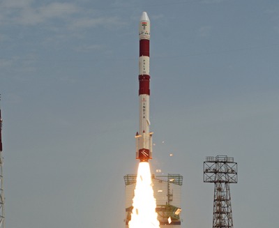
Narendra Modi became India’s prime minister on May 27. On June 30, after witnessing the launch of PSLV-C23, carrying the French earth observation satellite SPOT-7 (see “India and the satellite launch market”, The Space Review, June 30, 2014), he addressed India’s rocket scientists. While congratulating the Indian Space Research Organisation (ISRO) for the successful PSLV launch, he also outlined his vision for India’s space program. He argued in favor of changing the perception that India’s space program has an elitist agenda. He emphasized that space technologies are being used for socioeconomic development and, over the years, have proved their utility for common people.
During his speech, Prime Minister Modi also argued for the need to share India’s space expertise with its neighbors. He proposed to develop a “SAARC satellite” for the region and also to expand the footprint of India’s satellite navigation program to South Asia. This indicates that generally New Delhi is keen to use India’s expertise in space as an instrument of foreign policy. It’s worth examining and deliberating about the possible design of such a vision in the context of SAARC.
The South Asian Association for Regional Cooperation (SAARC) was established in 1985. This organization has a key focus on economic and developmental issues. SAARC has eight members: Afghanistan, Bangladesh, Bhutan, India, Maldives, Nepal, Pakistan, and Sri Lanka. Additionally, there are some nations with observer status, including the United States, Australia, Japan, and China. Myanmar (Burma) also has the status of an observer, but is keen to become a full member. This country shares more than 1,600 kilometers of borders with India. Owing to geographical and political realities for this discussion, Myanmar is thus considered as a part of SAARC.
Over the years, SAARC has evolved various areas of cooperation, and science and technology is one such area of interest. They have developed a cooperation mechanism that includes areas like environment, energy, education, and media. In the areas of science and technology cooperation, SAARC established a Meteorological Research Centre (SMRC) in 1995. It undertakes collective research in meteorology in the SAARC region. It has a modern and advanced observing system with a reliable and timely communications network. Also, there is a network for regional cooperation on subjects like hydrology, oceanography, seismology, and atmospheric science. Obviously, such networks rely on satellite-derived data.
Amongst the SAARC member states, India is the only spacefaring nation with a number of satellites operating in various orbits. Pakistan is another state with reasonable interest in space field. However, in spite of its early start and its knowledge of “rocket science” (it has a well-developed missile program), Pakistan has not made much progress in space arena. Their space agency, known as Space and Upper Atmosphere Research Commission (SUPARCO), was established during 1961 as a committee and was granted the status of a Commission in 1981. Badr-1 (Badr-A) was Pakistan's first indigenously developed satellite and was launched from China on July 16, 1990. This satellite is no longer operational. Pakistan’s second satellite, BADR-B, an Earth observation spacecraft, was launched on December 10, 2001. Subsequently, Paksat 1, its first geostationary satellite, was acquired in 2002. China launched Paksat-1R, a communication satellite for Pakistan, on August 12, 2011. In November 2013, a CubeSat called iCUBE-1 was launched in a polar orbit to take low-resolution images of the planet.
There are two other SAARC states with satellites in their inventory. One is Sri Lanka. Its first satellite is actually a commercial satellite and was launched by China in 2012. Otherwise, Sri Lanka is likely to launch its first geostationary communications satellite by 2015, in collaboration with a Chinese company. The other nation is Afghanistan, which started using its first satellite in May of this year. This satellite, called Afghansat 1, was acquired to boost the telecommunications sector. This is an orbiting Eutelsat satellite that was launched in December 2008 and with is designed to last until 2020. Afghan’s Ministry of Communications and Information Technology is renting this satellite for US$4 million per year.
Apart from these two nations, Bangladesh has shown some interest in research related to space. The Bangladesh Space Research and Remote Sensing Organization (SPARRSO), established in 1980, is a state agency concerned with astronomical research and the application of space technology. They propose to launch their first satellite, called Bangabandhu-1, around 2015. There are some unconfirmed reports that Maldives could be assisted by China to evolve their space agenda in near future.
| Considering the issues like necessities of member states, cost, time, and expertise required for development and launch of a satellite, the best option for India could be to develop an Earth observation satellite as the first SAARC satellite. |
This is the existing “SAARC space footprint” that is providing assistance to a limited population. By contrast, India’s proposed SAARC satellite would be serving the interests of entire SAARC population, almost 1.5 billion people. The SAARC region included many nations plagued by poverty and conflict. In this region, in a relative sense, India is an island of prosperity surrounded by states fighting to win over security and economic challenges. At the same time, within India there are also visible disparities between rich and poor. It’s also worth noting that two nuclear weapon states are the part of this grouping and there are some inherent security contradictions amongst some of the states in the region.
The geography of the SAARC region is unique, with coastlines, forests, deserts, and mountains. It has one of the youngest mountain ranges in the world, the Himalayas. They influence the major rain providing system for the region, the monsoon. The major rivers in South Asia are the Ganges, the Indus, and the Brahmaputra. Major deserts include the Thar Desert, which covers large areas of both Pakistan and India, with an approximate area of 175,000 square kilometers. Mainly tropical weather systems influence the Indian peninsula and other island states. Extra-tropical weather systems influence the survival of people staying close to Himalayan region. The region is prone for earthquakes, and a few tsunamis have taken place in the recent past.
These geophysical and geopolitical realities of the region should be taken into account before suggesting any model for the SAARC satellite. India needs to evolve a joint mechanism involving representatives from all member states to decide on the expectations from the proposed SAARC satellite. Before designing such a satellite, it would be important to identify and zero in on the specific and urgent needs of the nations in the region. Broadly, the various socioeconomic challenges of SAARC nations could be at least partially addressed by communications satellites, weather satellites, and remote sensing satellites.
Considering the issues like necessities of member states, cost, time, and expertise required for development and launch of a satellite, the best option for India could be to develop an Earth observation satellite as the first SAARC satellite. Basically, such a satellite could be of much use for land and water resources management for the entire region. India would also be expected to assist member states to develop ground infrastructure and create expertise. Some analysts believe that, at times, SAARC gets held hostage to the divergence of the India-Pakistan relationship. In fact, satellite technology could come very handy to silence such critics. As confidence building measures, such technology could be used to undertake joint surveillance of the border regions and resolve issues related to infiltration, water sharing, and more.
India’s Regional Satellite Navigational Network is likely to become operational by the end of 2015. As suggested by Prime Minister Modi, India could offer these facilities to the SAARC states as well. To assist civilian aircraft for navigation and non-precision approaches over India airspace, ISRO has developed a GPS-Aided Geo Augmented Navigation (GAGAN) system. India could also allow access to this system to aircraft operating within SAARC airspace.
| In an era of tremendous growth in information technologies, the Internet, mobile telephony, and social media, satellite technology could form the basis to establish a common SAARC identity. |
Presently, what is important for India is not to limit itself with the idea of a SAARC satellite but instead to effectively use its existing capabilities in space to assist the various SAARC members. Most of these nations, being novices in the field of satellite technology, may not be in a position to ask India for specific assistance. India needs to become proactive and share with these nations imagery and other relevant data. In 2005, the Asia-Pacific Space Cooperation Organization (APSCO) was established, which is the only multilateral space mechanism presently available for the region. Among the SAARC members, only Bangladesh and Pakistan are members of APSCO and, from the SAARC point of view, such a body is not of much use. India could take a lead to establish a SAARC space cooperation mechanism, which could also bring more transparency into the system. Such agency could play a major role towards coordinating various data sharing and training related activities.
In SAARC, India is the dominant player; in the space arena, it is the only player. It is important for India to guard against developing any form of so-called “big brother attitude.” While establishing a relationship with other nations, India should not play only the role of assister. India needs to develop a system where these nations could be made partners in various activities. To reduce rivalry (if any) and promote solidarity among members, India could engage these nations in important space projects to create a sense of belonging. Presently, India is working on a program to develop Astrosat, a dedicated astronomy satellite that is likely to be launched in 2015. India could involve SAARC members in this project and could call this satellite “SAARC Astrosat.” Also, with the Sri Lankan government, India could undertake a feasibility study for developing a joint spaceport in that country.
SAARC region is bound together not only by geography but also (in some sense) by culture, ethnicity, traditions, religion, and languages. At the same time, this region has various strategic fault lines with strong differences on issues among some member nations. Any proactive collaboration in the outer space arena is unlikely to resolve all issues of differences. However, in an era of tremendous growth in information technologies, the Internet, mobile telephony, and social media, satellite technology could form the basis to establish a common SAARC identity.