India’s indigenous satellite navigation systemby Ajey Lele
|
| Was there really a need for India to develop an independent navigational system? |
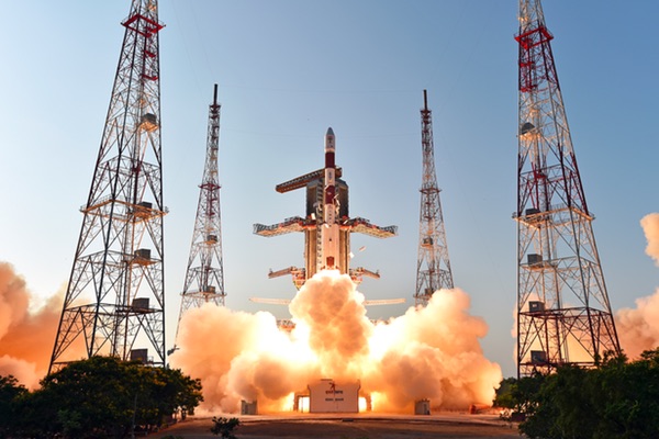
India began its journey in the field of navigation with the launch of its first IRNSS-1A in July 2013. The second satellite, IRNSS-1B, was launched on April 4, 2014, and IRNSS-1C launched on October 16, 2014. India expects to complete the seven-satellite constellation by end of this year or early next year by launching the remaining three satellites in quick succession.
IRNSS has a different configuration than other global navigational systems. Normally, navigational satellites, like the American Global Positioning System (GPS), are positioned in medium Earth orbit (MEO). In case of IRNSS, four satellites will be in inclined geosynchronous orbits and the remaining three satellites in the geostationary orbit.
IRNSS is designed to offer accurate position information within India and up to 1,500 kilometers outside of the country’s boundaries. This system would provide a position accuracy of better than 20 meters in the primary service area. IRNSS will provide two types of services: Standard Positioning Service (SPS) available to all the users, and Restricted Service (RS), an encrypted service provided to specific users. The entire system would have a lifetime of minimum of ten years.
Was there really a need for India to develop an independent navigational system? It’s important to address this question at the backdrop of some global navigational sector realities.
For years, many nations have been using GPS, which offers real-time position, navigation, and timing (PNT) services. GPS is controlled by the US Air Force and has a global footprint; it remains the most popular global navigational system. The GPS signals are made freely available to users and its global importance is unlikely to diminish in spite of other options becoming available in near future. The Air Force continues to upgrade this system with new spacecraft: just a few days ago it launched the GPS 2F-9 satellite to replace a spacecraft that was launched in 1993.
During the Cold War, global satellite navigation was one area where the United States clearly had an edge over the Soviet Union. The Russian constellation, called GLONASS, finally became operational in 1995. However, because of financial problems this system remained partially functional for many years and was not able to provide global coverage. Russia restored GLONASS to full operations in recent years.
A number other navigational systems are currently under development. China, Japan, India, and the European Union (EU)/European Space Agency (ESA) are in the process of deploying their individual systems; some of these systems offer limited services today.
The EU has an ambitious programme called Galileo. This system would have 30-satellites (24 operational and 6 active spares) and is expected to become ready by 2020. Galileo proposes to start offering first services from 2016. Just a day before the Indian launch, on March 27, a Soyuz rocket launched a pair of Galileo satellites. This system now has eight satellites in orbit. Mainly owing to financial problems the development of this system has suffered from various delays for all these years.
| Those states that have a reasonable capability in space arena are in the process of developing their own navigation systems. |
On the other hand, China has made an impressive beginning in the area of satellite navigation. They started with what could be described as a pilot product. Their BeiDou (or BeiDou-1) Navigation Satellite System began with a three-satellite system. The first satellite in this system was launched in October 2000 and system became operational by 2003. An additional fourth satellite in this system launched in 2007. The system has a projected accuracy of 10 meters.
Learning from the development and operations of that system, China has started BeiDou-2 (Compass). It is a 35-satellite constellation—five in geostationary orbit and 30 in MEO—and is currently under development. More than half of these satellites have already launched. This system started offering services covering the Asia-Pacific region in December 2012. The entire system is expected to become operational by 2020.
Japan, like India, is also developing a regional system. Their system called Quasi-Zenith Satellite System (QZSS) is under the process of development (it may be completed by 2017 or 2018) and would have four satellites while aiming at a final seven-satellite constellation in the future.
All this clearly indicates that those states that have a reasonable capability in space arena are in the process of developing their own navigation systems. There are significant utilities for such systems for civilian applications, and the commercial benefits of such constellations are well-known. However, the strategic reasons for developing such systems are equally important. GPS is essentially a military system that was made available for civilian use after a Korean airliner was shot down by Soviet interceptors in 1983 because of an airspace violation, killing 269 passengers. After this, then US President Ronald Reagan made the GPS available globally to avoid future navigational problems.
The GPS signals made available globally are intentionally degraded signals so as to avoid any military-specific utility. The US has the capability to block the civilian signals while still being able to use the military signal (M-band). Hence, there exists a possibility that the US could deny others access to GPS during political disagreements. Also, owing to topography and terrain features there could some blind spots for these signals. States like Japan face problems from high-rise buildings and indoor locations that block or degrade signals.
Today, navigation systems are the heart of aviation and shipping, be it civil or military. The 1991 Gulf War significantly demonstrated the utility of navigational systems for militaries. All modern-day weaponry and weapon delivery platforms are dependent on navigational systems. The threat perceptions of countries like India and Japan are well-known. Owing to North Korean challenges, Japan has already invested in spy satellites and their focus towards developing an independent regional navigational system is understandable.
India’s strategic requirements are regional and their initially investments are towards developing a regional system. India’s adversaries, like China and Pakistan, are nuclear weapons states and they also have a significant inventory of state-of-art missiles. Also, China has committed to provide Pakistan with a “military-quality” signal from its BeiDou system. Naturally, India needs to have a reliable and accurate space-based navigational system. Like any other space navigational system, IRNSS is also dual-use. The system has utility for terrestrial and maritime navigation, in agriculture and disaster management, and various other applications. It is expected that this system would have significant commercial benefits, too.
| It appears that for India IRNSS is not about any competition, but instead a way to attain strategic parity. |
One question that always gets debated is whether India is trying to match China by making such investments. The basic issue is that India is modernizing its military owing to the nature of threats the country faces. It would be of no use to acquire fourth-or fifth-generation fighter aircraft and not have a compatible satellite-based navigation system. India could probably depend on GLONASS for the platforms and weapons of Russian origin. But, India also has military equipment from the US, Israel, and European origin, where GLONASS would have limitations. India had proposed to make significant financial investments into Europe’s Galileo program, but was denied the military rights of this system.
By 2006, India started articulating the need for the development of its own system for multiple uses. In the civilian domain, India has good commercial prospects. This is because there is a tremendous growth potential in the global navigational market. IRNSS would be compatible with some of the other systems, too. All this would allow India to develop a market for itself. India also proposes to offer the IRNSS signals to the states in its neighborhood, a novel way of using space assets for diplomacy. It appears that for India IRNSS is not about any competition, but instead a way to attain strategic parity.