The evolution of India’s weather satellite programsby Ajey Lele
|
| The Indian establishment realized during the early phases of its space program in the 1970s that the field of meteorology would greatly benefit from satellite technologies. |
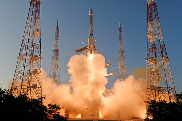
INSAT-3DS is a 2274-kilogram satellite launched for meteorological purposes. There is an additional element of data relay and satellite-aided search-and-rescue service. According to ISRO, there are four main payloads. The Imager Payload is for generating images of the Earth and its environment in six wavelength bands. The Sounder payload has one visible channel and 18 narrow spectral channels. It would provide information on the vertical profiles of the atmosphere like temperature and humidity. The third payload is a Data Relay Transponder (DRT) for receiving global meteorological, hydrological, and oceanographic data from automatic data collection platforms and Automatic Weather Stations (AWS), and would relay the information back to the user terminal. The only non-meteorological payload is a satellite-aided search-and-rescue (SA&SR) transponder meant for relaying a distress signal for search-and-rescue purposes with global receive coverage in UHF band.
The geographical landscape of India is fascinating. India is a peninsular state and has the mountain ranges of the Himalayas to its north. The Thar Desert (the Great Indian Desert) is in the northwestern part of the Indian subcontinent, including parts of India and Pakistan, and around 85% portion of this desert is in India. From Thar to Siachen in the Himalayas, within a distance of around 1,000 kilometers, the variation in temperature is more than 100 degrees Celsius (–50 deg C at Siachen to +50 deg C in the desert region.) By contrast, the northeastern part of India has the most extensive forest cover.
The Indian state experiences the vagaries of weather frequently. India receives the major portion of the rainfall during the Southwest Monsoon period, which on many occasions floods the Northeast parts of the country. Over the years, the state has experienced some drought years too. Peninsular India gets impacted by cyclonic storms and hurricanes mainly during the months of April and November. Weather systems like Western Disturbances are mainly responsible for rain and snowfall over the northern parts of the country. Most parts of India lie in the subtropical region, while the northern parts experience extra-tropical weather patterns. India is an agricultural economy and Indian farmers depend on weather forecasts.
The Indian establishment realized during the early phases of its space program in the 1970s that the field of meteorology would greatly benefit from satellite technologies. India’s agriculture sector was losing much during those days owing to the country’s inadequacies in weather foresting and providing timely weather inputs to the farmers. Some studies indicate that as many as 117 cyclones hit India in 50 years from 1970 through 2019, claiming more than 40,000 lives. Most of these deaths owing to weather had occurred during the 20th century. Today, thanks to the availability of satellite imagery, adequate early warning of the approach of cyclonic storms and hurricanes are given by the weather forecasters and disaster management agencies, which ensures timely evacuation from the coastal areas.
ISRO's INSAT (Indian National Satellite System) program officially began in 1976. This has been a unique project in the world where a satellite system was developed to undertake both telecommunications and meteorological tasks. In those days, owing to budgetary limitations, ISRO was developing multipurpose satellite systems. There were different stakeholders for the INASAT program like the Department of Telecommunications and TV and radio agencies. Another important stakeholder was the Indian Meteorological Department (IMD). The initial missions of INSAT during the early 1980s had a meteorological payload called Very High-Resolution Radiometer (VHRR).
During the early 1980s, ISRO faced problems with the INSAT-1 program. The INSAT-1A satellite had a meteorology package consisting of a scanning very-high-resolution, two-channel radiometer to provide full-frame, full-Earth coverage every 30 minutes. This satellite was launched on April 10, 1982, but started facing problems within a few months. INSAT-1B also had some issues. However, INSAT-1C and -1D were successful missions and provided IMD with imagery for many years. INSAT-2A, -2B, and -2E were multipurpose satellites with meteorological payloads, and the same is the case with INSAT-3A and -3C.
| The time has come for IMD to look beyond ISRO and be involved in more international projects and engage India’s private industry to fulfill their requirements. |
India became a spacefaring state in 1980, but only in September 2002 did it launch its first dedicated meteorological satellite called Kalpana-1, which was deactivated in September 2017. INSAT-3D (July 2013) and INSAT-3DR (August 2016) were satellites launched mainly for meteorological purposes in the INSAT series. They have data relay and satellite-aided search-and-rescue systems as well. In September 2016, ScatSat-1 (Scatterometer Satellite-1) was launched by ISRO to provide additional weather forecasting, cyclone prediction, and tracking services. This satellite lasted for around five years.
In October 2011, ISRO launched a 1,000-kilogram Indo-French weather observation satellite called Megha-Tropiques. This was India’s first major joint space project with France in the field of meteorology. The satellite was deactivated in April 2022. Another such joint mission is a satellite called SARAL with altimetric measurements designed to study ocean circulation and sea surface. This system entered into service in June 2013 and is still active.
ISRO has a series called Oceansat for the purposes of oceanography and atmospheric studies. So far, three Oceansat Earth observation satellites have been launched, starting with Oceansat-1 in May 1999. At present, Oceansat-2 and Oceansat-3 are operational.
The recent launch of INSAT-3DS was much awaited. This requirement was projected to ISRO by the Department of Earth Sciences, which includes IMD. Since its beginning, ISRO has been innovative in regard to catering to India’s metrological requirements. Looking at India’s overall space efforts, it could be possible that ISRO has had limitations in regards to investing big in the area of meteorological satellites. Today, in this era of climate change, much is expected from IMD by its stakeholders, academic institutions, and the public. The existing satellite network available to IMD needs expansion. The time has come for IMD to look beyond ISRO and be involved in more international projects and engage India’s private industry to fulfill their requirements.
Note: we are now moderating comments. There will be a delay in posting comments and no guarantee that all submitted comments will be posted.