Will China compel the development of GPS 4?by Taylor Dinerman
|
| The Chinese are going to try to do to both America’s GPS 3 and Europe’s Galileo systems what the Europeans, under French leadership, tried to do to the US. |
China’s existing Beidou navigation network is a clumsy system based on three satellites, (two operational and one reserve) in geosynchronous orbit, launched between 2000 and 2003. Its military uses have been limited, but it is suspected that they include providing guidance for the ICBMs China has aimed at US targets. Above all, this system has given China hands-on operational experience with satellite navigation hardware. Combined with the sophisticated science and engineering data they have been able to obtain from Europe, they are now in a position to begin work on their own military satellite navigation system. Australia, the US, Japan, and India can thank the good folks at ESA and the EU for the subsequent increased instability—or worse—in the region.
The proposed Compass system will not be operational for a long time to come, so the US has time to adjust its own plans to prevent the Chinese system from having the ability to harm US military operations. This will mean that the current GPS 3 program will have to be curtailed or modified beyond recognition. The generation after next of GPS satellites will have to include much more robust methods for overcoming or avoiding enemy interference. These could include not only such tried-and-true concepts as frequency hopping and pseudo-random burst transmissions, but also space-to-Earth laser communications with navigation information embedded in ordinary military communications.
In the long term this could create some interesting opportunities for the Transformational Satellite (T-Sat) communications program to work with the designers of the future GPS system. Navigation and communication systems complement one another nicely, something the Chinese have already figured out since the Beidou system has a limited communications capability. The US may have to rethink the whole of its future, post-2020 military space architecture.
Since future military space operations will likely take place throughout the Earth-Moon system, any future navigation system will have to cover this area. Some satellites in such a system will have to be placed beyond the Moon’s orbit, while others will be in cislunar space. Such a system will also have the opportunity to take advantage of the naturally occurring navigation signals given off by the sixteen pulsars that can be received in our part of the galaxy.
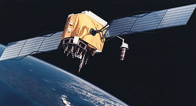
| For the US the best solution would be to limit the GPS 3 program to three or four satellites and proceed directly to a “GPS 3.5” and then to GPS 4. |
In his 1993 speech presenting the Nobel Prize for Physics to Russell Hulse and Joseph Taylor, Carl Nordling of the Royal Swedish Academy of Sciences explained that a pulsar “continuously emits a radio signal in two beams that sweep across space, resembling the beam from a lighthouse.” He goes on to explain that “its frequency is very stable, fully comparable with that of atomic clocks.”
Since these clocks, and similar devices such as active and passive hydrogen masers, are the core operational elements of any modern satellite navigation system, it would seem that using pulsars in any future space or terrestrial navigation system is too good an idea to pass up. It will be interesting to see if anyone can come up with a way to jam these signals, but as adjuncts to a future large-scale navigation system they will be invaluable.
For the US the best solution would be to limit the GPS 3 program to three or four satellites and proceed directly to a “GPS 3.5” and then to GPS 4. By building a system with an ever-higher-quality signal and with ever-increasing robustness and applicability, the US will not only stay in the forefront of satellite and space-based navigation technology, but will prevent either the Europeans or the Chinese from gaining military navigation, timing, and positioning capability that comes close to matching our own.